We uploaded Photosynth(s) of Tuvalu.
There are typical 7 synthes of Funafuti available. (plug-in is necessary)
As we wrote, we took 5000 or more pictures in Tuvalu including photographs on all roads of Funafuti. We are making much more synthes.
See also: Photosynth of Nakagin Capsule Tower
28 July, 2009
27 July, 2009
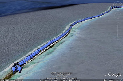
3200 Photographs with GPS of Tuvalu
We uploaded 3200 Photographs with GPS of Tuvalu as the first of the result of a joint research with NPO Tuvalu OverView.
It can be viewed with Google Earth and Picasa Web Album.


These photographs can be freely used for a non-profit-making purpose. Please contact us when you want to use it for profit.


Photographs:
Hidenori Watanave Laboratory @ Tokyo Metropolitan University
(Makiko Suzuki, Hidenori Watanave)
Supported by:
Tuvalu OverView and Photon,Inc.
and also, we are making 3D photograph oriented space of Tuvalu by using Virtual Worlds. Experimental version that uses Microsoft Photosynth are open to the public.
It can be viewed with Google Earth and Picasa Web Album.
- KML for Google Earth
- Web album (Sky of Tuvalu)
- Web album (Eye-level #1)
- Web album (Eye-level #2)
- Web album (Eye-level #3)


These photographs can be freely used for a non-profit-making purpose. Please contact us when you want to use it for profit.


Photographs:
Hidenori Watanave Laboratory @ Tokyo Metropolitan University
(Makiko Suzuki, Hidenori Watanave)
Supported by:
Tuvalu OverView and Photon,Inc.
and also, we are making 3D photograph oriented space of Tuvalu by using Virtual Worlds. Experimental version that uses Microsoft Photosynth are open to the public.
21 July, 2009
The last day: Eclipse in Tuvalu
 |
Today is the last day of our reserch. We take photographs of Eclipse in Tuvalu. 85% of the sun was lacked in Tuvalu.
 |
 |
And also, we took HD movies of Eclipse, we will upload it soon.
A perfect rainbow appeared on the opposite side of the sun.
 |
20 July, 2009
The 6th day in Tuvalu: Mission completed
 |
We completed the collection of 5563 photographs with GPS route in Funafuti.
- Almost sequences of all roads
- Partial coastlines
- Panoramic pictures of several places
- Inside of houses
- Coastline and planting in the south end of Funafuti atoll
- Sky and surfaces of ground
 |
| From tuvalu2009 |
And also, following videos.
- Fixed camera movies from insect view of several places
- Continuous sequences from north end to south end with special camera
 |
We will share kml data (Placemarks and Photooverlays) on August.
18 July, 2009
The 3rd day in Tuval
Yesterday, we went Funafara, south-edge of Funafuti atoll by boat. We got GPS log and pictures on the way to Funafara.
We plan to take geostationary frame HD movies, coastline, detailed alley, etc. while staying for more four days.
 |
| From tuvalu2009 |
 |
| From tuvalu2009 |
 |
| From tuvalu2009 |
We plan to take geostationary frame HD movies, coastline, detailed alley, etc. while staying for more four days.
17 July, 2009
GPS mapping of Tuvalu
 |
| From tuvalu2009 |
Now I'm in Tuvalu with a student of Hidenori Watanave laboratory @ Tokyo Metropolitan University and NPO Tuvalu Overview.
We are correcting a lot of pictures, and we will make thousands of placemarks and photo-overlays of Tuvalu on Google Earth, and 3D photograph-oriented space in Second Life, and supporting+communication system of the activity of Tuvalu Overview. Tempolary situation of material collection is as follows.
|
| From tuvalu2009 |
 |
| From tuvalu2009 |
 |
| From tuvalu2009 |
And I uploaded test version of panoramic picture of Tuvalu. This place is the narrowest point in Tuvalu. A violent open sea faces a quiet lagoon. This is a scene that symbolizes Tuvalu on the borderline between development and native exist.
You can scroll it.
It will be open to public in September 2009.
Subscribe to:
Posts (Atom)